
Halfway down page 183 of Japan’s official gazette for 22 November 1946, a hydrographic notice delivers an unusual verdict. Under the heading for the southern islands, it names Nakanotorishima and declares it nonexistent. What follows is remarkably practical. Delete a symbol. Erase the name. Strike two lines from an index. An island, it turns out, can require several passes of the eraser. Official Gazette, issue 5959, scan 8
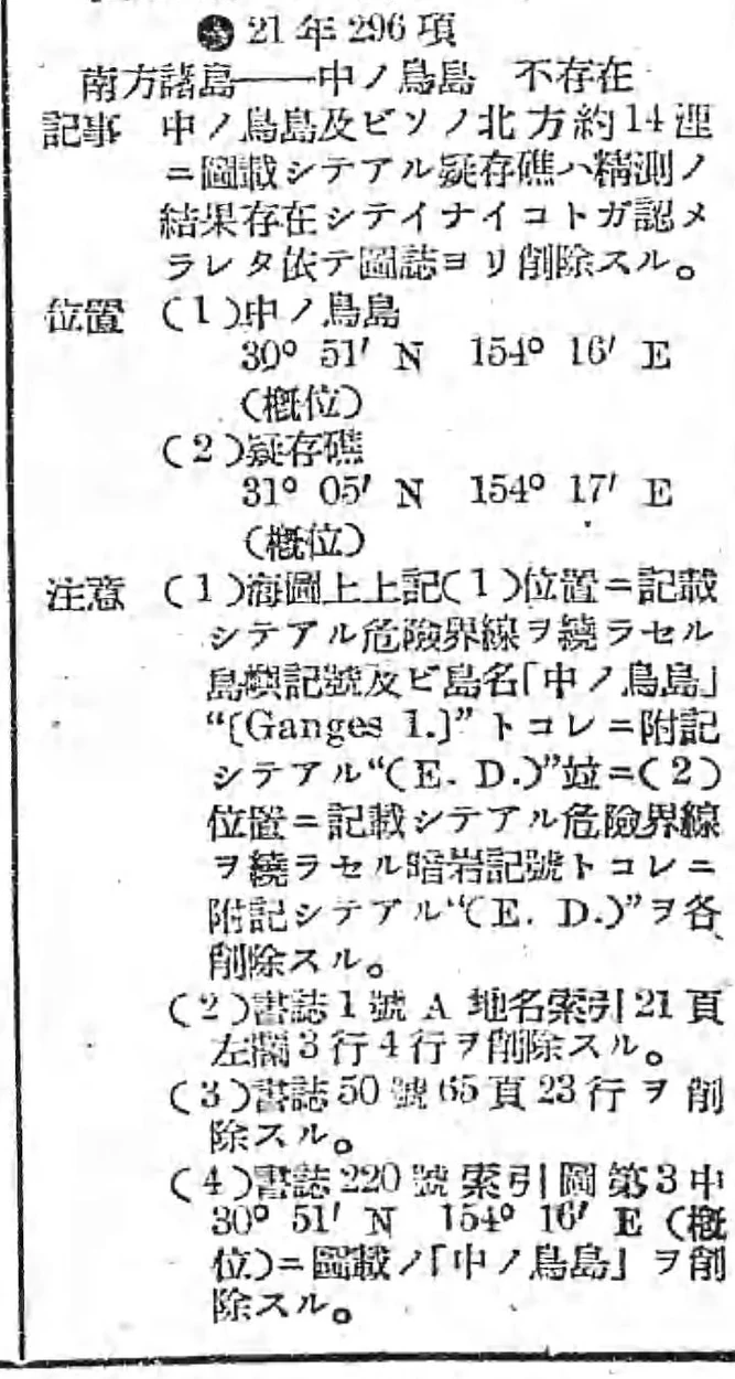
National Diet Library, Official Gazette, p. 183, rotated and cropped. In notice 296 of 1946, item (1) is the island and item (2) the suspected reef to its north. Full page
A landing place called West Port
In April 1908, Yamada (山田禎三郎) filed a report about an island he said he had surveyed east of the Ogasawara, or Bonin, Islands the previous August. Its area was 643,700 tsubo, about 2.13 square kilometres. No drinking water sprang from the ground. There were screw pines and black and white albatrosses. He divided the land into three districts and provisionally named the landing place in the western district West Port. It is possible to picture the place from the deck of a boat. But the detail about drinking water, the trees and the birds all come from the same account. We are looking over the applicant’s shoulder. Discovery report, frames 26–27 in the National Archives of Japan · Japanese transcription
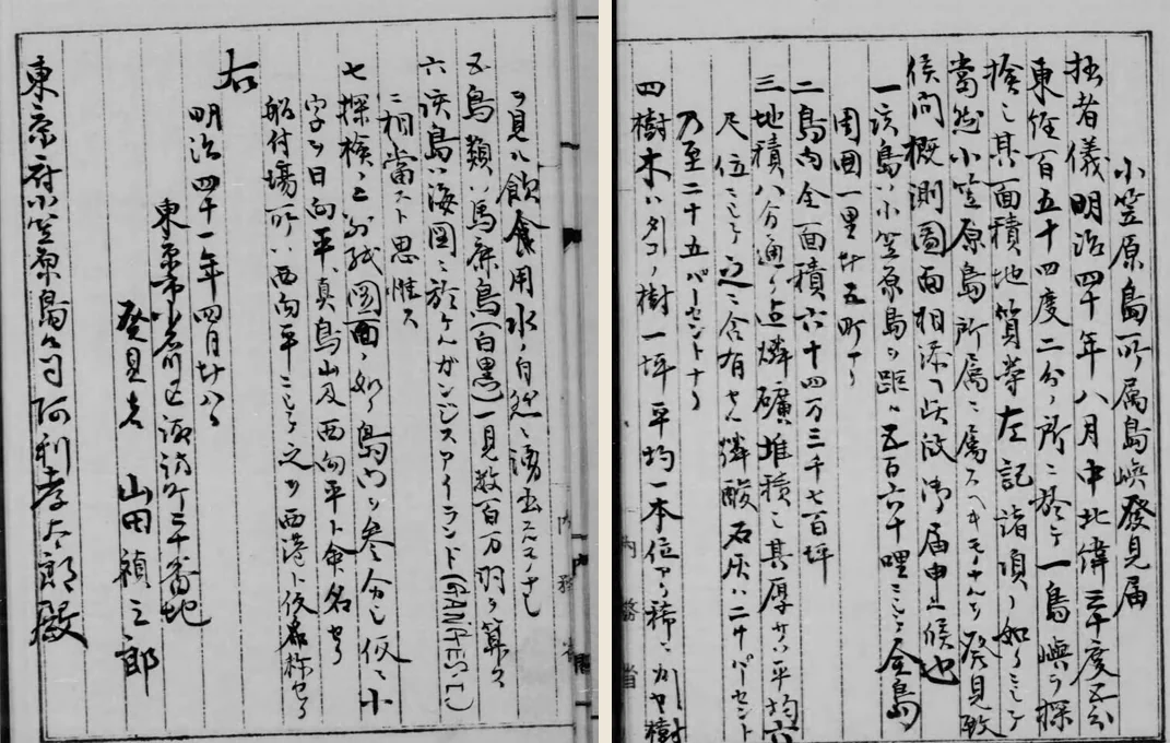
National Archives of Japan, Kōbun Ruijū, extracts from frames 26 and 27 arranged in Japanese reading order, right to left. The physical description begins on the right. Yamada’s name appears at the end on the left. Original file
Turn to frame 28, immediately after the report. Where you might expect an island outline, there is a photographed slip directing the reader to consult the original for drawings or tables. A separately reproduced copy of the attached sketch shows line after line looping inside the coast like the rings of a sliced onion. Look for elevation numbers on those lines and you come away empty-handed. There is a page that answers the question “How did Yamada draw the island?” It takes a different kind of record to answer “Who established where it was?” Frame 28 in the file · The attached sketch and a discussion of its terrain lines
Yamada thought he had found the feature already marked Ganges Island. There was a problem when officials compared the numbers. His position was 30°05′ N, 154°02′ E. The sailing directions placed Ganges Island at 30°47′ N, 154°15′ E. The latitudes alone differ by 42 minutes. At about one nautical mile per minute of latitude, that is roughly 78 kilometres north to south, even before accounting for longitude. A third position occurs in the postwar notice. The name was moving between documents long before anyone set about erasing it. Cabinet file and catalogue · 1946 notice
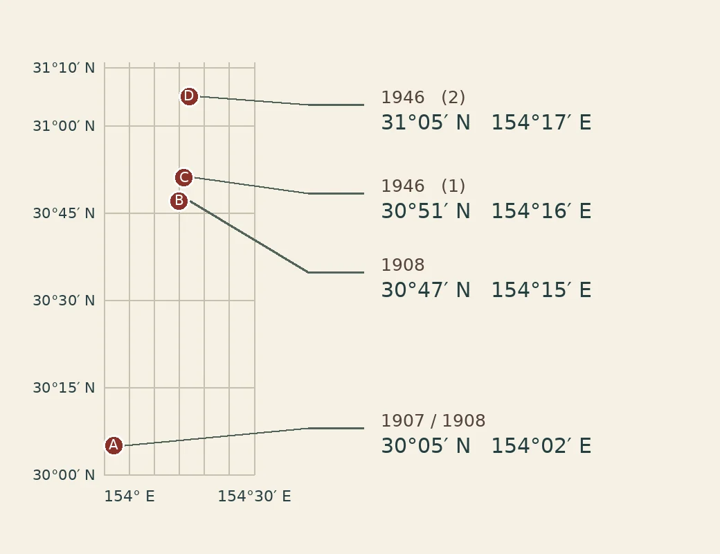
Plotted from the documents. A is Yamada’s position, B the island in the sailing directions, C and D the island and suspected reef in the 1946 notice. The latter expressly calls both positions approximate. Cabinet file · Official Gazette
The officials had noticed
Read the right-hand page of the Cabinet file. It says the position of Ganges Island was marked doubtful. A sentence that runs across the binding says its position must be established another day. Keep reading, and the same document proceeds to the matter of naming the island and putting it under the Ogasawara Island Office of Tokyo Prefecture. There was a reason an administrator might want a jurisdiction settled. The applicant wanted to lease the land to catch birds and mine phosphate. Someone had to receive the application. The government decided the name and jurisdiction in July. The decision is excellent evidence of an administrative act. Cabinet file, frames 4–5 and the Tokyo governor’s submission in frame 25 · Akitoshi Hiraoka’s research on albatross hunting and resource claims
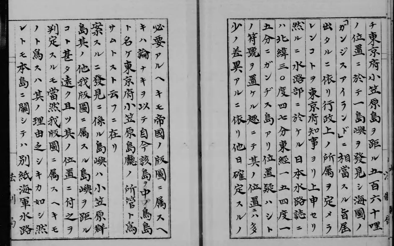
National Archives of Japan, Kōbun Ruijū, cropped from frame 4. The sentence postponing a definitive position runs from the end of the right-hand page to the start of the left. Original file
Expeditions failed to find land. The feature was removed from confidential Japanese hydrographic publications in 1943. Then came the public notice of 1946. Look for the tiny letters E.D. after the island’s name. They are the chart abbreviation for existence doubtful. The notice ordered the danger limits, the symbols and those accompanying letters removed for the island and the reef. A chartmaker had good reason to warn a mariner about a possible hazard. The mark on a chart had never, by itself, amounted to a witnessed landing. Government account of the removals · International Hydrographic Organization chart specifications, B-424.3
What the eraser missed
On 7 April 1998, Yoshioka Yoshinori brought the island up in a committee of Japan’s House of Councillors. Five days earlier he had asked the government to identify the office a citizen could consult on territorial matters. A native of Shimane Prefecture interested in the history of island annexations, he said it had taken him years to trace the hydrographic deletion. He still had a question. When and by what procedure had anyone dealt with the Cabinet decision declaring the island Japanese? Yoshioka’s earlier request · His question on 7 April
Chief Cabinet Secretary Muraoka Kanezō confirmed that the island’s existence had not been established. As for the old decision, the events were distant and involved several offices. He could not establish the details on the spot. The exchange supplies neither a cancellation date nor the name of a procedure. What survives at the end of the trail is a small, precise difficulty. The person erasing a hazard from a chart and the person looking for the fate of a Cabinet decision were consulting two different sets of books. Muraoka’s reply · The following intervention